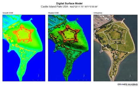
Topographic survey made from open source imagery. geomatics June 24, 2016 Open-source 3D modeling. Open-source 3D modeling: Topographic survey & 3D modeling of Castle Island made using satellite imagery from Continuer la lecture
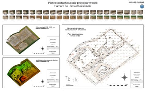
Survey plan and volumetric calculations produced by aerial... geomatics June 11, 2016 Survey plan and volumetry Survey plan and volumetry of the Puits et Nuisements quarry. Results obtained from 740 aerial Continuer la lecture