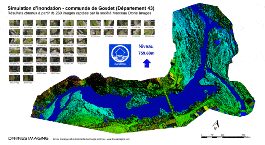
Flood simulation for DREAL geomatics August 22, 2017 Flood simulation for dreal (Regional Directorate for the Environment, Planning and Housing) Flood simulation carried out by aerial photogrammetry Continuer la lecture
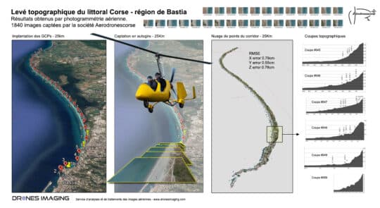
Topographic survey for coastal erosion monitoring geomatics August 18, 2017 Photogrammetry by gyroplane and topographic survey carried out for coastal erosion monitoring Photogrammetry by gyroplane: mapping and 3D modeling Continuer la lecture