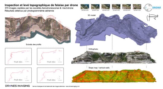
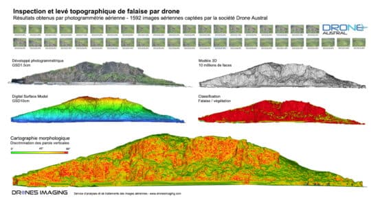
Cliff inspection by drone and photogrammetry geomatics September 24, 2018 Cliff inspection by drone and aerial photogrammetry in Bonifacio Cliff inspection, September 2018. Results obtained from 370 aerial images Continuer la lecture
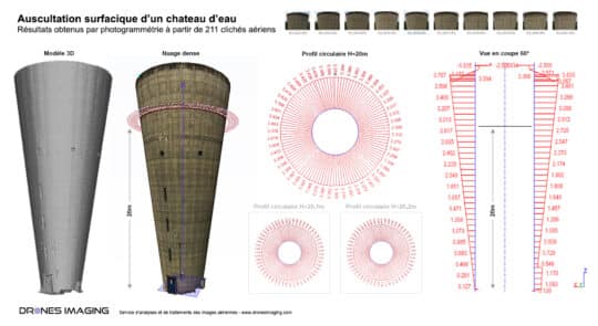
Inspection of structures by drone – circularity study... geomatics August 10, 2018 Engineering structure inspection: circularity study of a water tower by photogrammetry. Engineering structure inspection: results obtained from 211 aerial Continuer la lecture
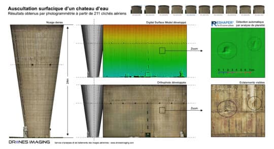
Auscultation of a water tower walls by drone... geomatics April 17, 2018 BIM inspection by drone and automatic detection of disorders BIM inspection by drone: results obtained from 211 aerial shots Continuer la lecture
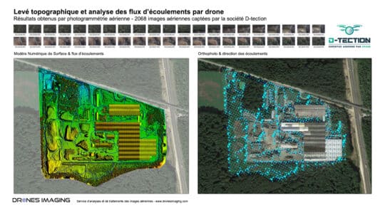
Technological risks study by drone – flow analysis... geomatics March 14, 2018 Technological risks study by drone – flow analysis and simulation of pollutants dispersion. Technological risks study by drone : Continuer la lecture
3D survey of the Cap Champagne cliff –... geomatics March 6, 2018 Cliff survey of the Cap Champagne carried out by drone and photogrammetry – Reunion Island Cliff survey carried out Continuer la lecture
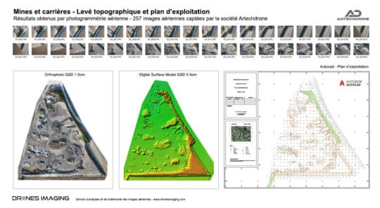
Topographic survey and annual mining map geomatics March 2, 2018 Annual mining map and stockpiles calculation made by drone and photogrammetry. Annual mining map and stockpiles inventory. Results obtained Continuer la lecture
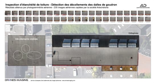
Roof inspection by drone and photogrammetry geomatics February 26, 2018 Roof inspection by drone. Roof inspection by drone: detection and localization of sealing plate peeling off. Results obtained from Continuer la lecture
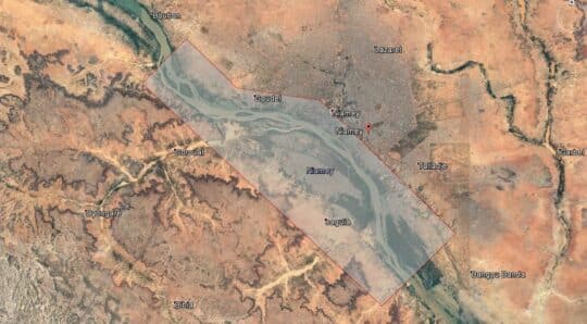
Flood forecasting: Topographic survey in Niamey to deal... geomatics January 19, 2018 Flood forecasting: Topographic survey in Niamey to deal with the rise of the Niger River Flood forecasting by aerial Continuer la lecture