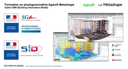
Ministry of the Armed Forces – Training course... geomatics August 12, 2020 photogrammetry training BIM option (Building Information Model) Photogrammetry training BIM option carried out in two parts using the Agisoft Continuer la lecture
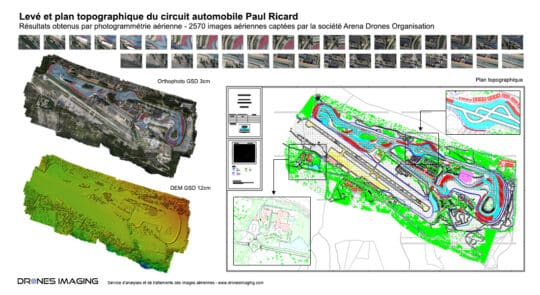
Le Castellet – Survey and topographic map of... geomatics March 12, 2020 Le Castellet – Survey and topographic map of the Paul Ricard racing circuit made by drone and aerial photogrammetry Continuer la lecture