Topographic survey of 1100 hectares carried out by aerial photogrammetry
Aerial photogrammetry by gyroplane: results obtained from 2600 aerial images taken by the company Artech Drone. Images post processing by Drones Imaging.
Aerial photogrammetry by gyroplane: orthophoto and Digital Surface Model
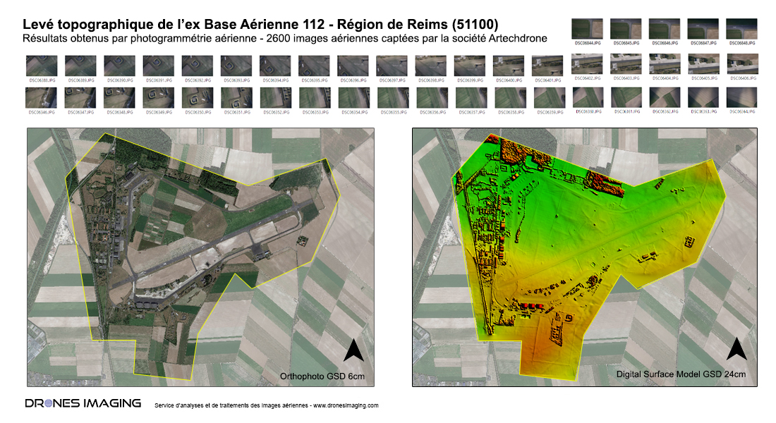
Orthophoto and Digital Surface Model built as part of the rehabilitation of the former Air Base 112. Service carried out in 1h30 flight and delivery of geographical datas on D+2.
TECHNICAL INFORMATIONS
- Imagery processing service : Drones Imaging company
- Aerial captation : Artech’Drone company
- Spatial accuracy : centimeter.
- Orthophoto RVB : GSD 6cm
- Total covered area : 1100ha
- Airborne platform : gyroplane
- Photogrammetry software : Agisoft Metashape
- Dense cloud : 140 millions points
- Export formats : GéoTiff and Las
- Post processing delay : 2 days
- Use case taught in training : see more