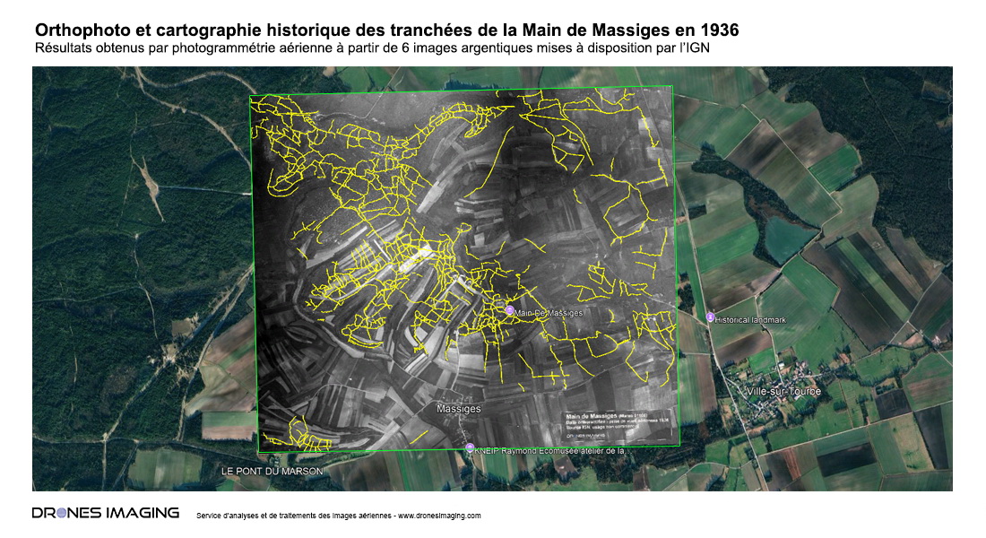
Mapping of the trench network at the Main de Massiges created from 1936 aerial film images
A detailed map of over 84 linear kilometers of trenches at an iconic site of the Battle of the Marne, created using argentic photogrammetry
In the field of geomatics, aerial photographic archives offer a fascinating potential for exploring the past. While searching the historical database of the IGN, we discovered a true treasure: six aerial photographs taken in 1936, just 18 years after the end of World War I. These unique images provide a striking perspective of the Main de Massiges, an iconic site of the Battle of the Marne. Thanks to their exceptional preservation quality, the trenches remain perfectly visible, bearing witness to the landscapes marked by the fighting. These images, imbued with memory, offer a poignant glimpse into the soldiers’ lives and help preserve the memory of this historical event.
Leveraging our expertise in photogrammetry, we transformed and analyzed these historical photographs, revealing a complex network of trenches. This work allowed us to reposition these historical remnants onto the current landscape, notably through Google Earth.
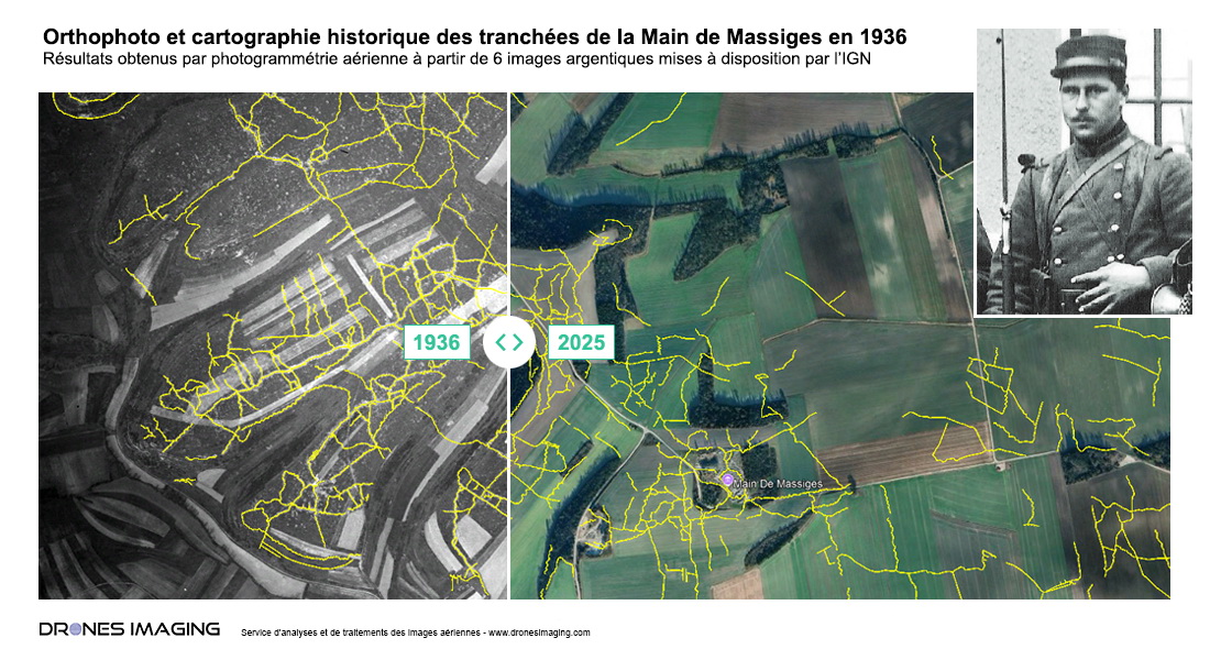
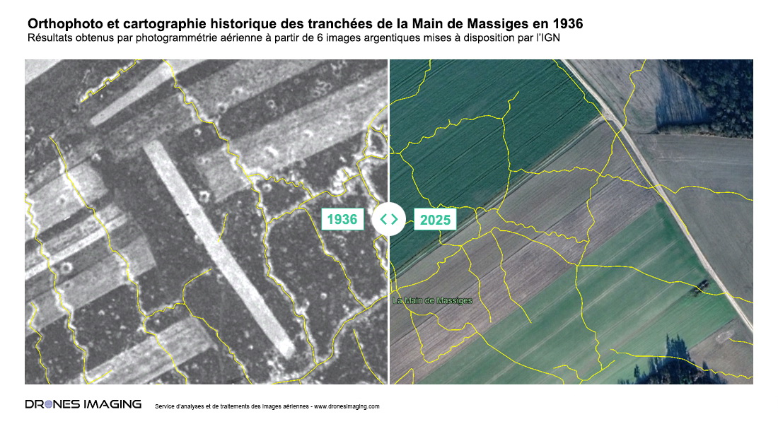
A general view of the site in 2025 with an overlay: the 1936 imagery and the vector layer of the trench network.
Step 1 : Argentic photogrammetry
The six raw aerial photographs, which contained distortions typical of the analog equipment of the time, had to be corrected using the photogrammetry software Agisoft Metashape, in three distinct steps:
- Image alignement via dense correlation : Automatic identification of matching points to calibrate the camera used in 1936.
- Image stiching : Correction of focal distortions and creation of a single, color-corrected mosaic.
- Georeferencing: Use of visible geographic markers from both 1936 and 2025 (such as intersections, paths, and settlements) to accurately position the mosaic within the current coordinate system used by Google Earth.
Step 2 : Generation of the map model
Once the images were stitched and georeferenced, this image mosaic served as the basis for:
- Analysis of surface and underground characteristic signatures through photo-interpretation, allowing the identification of the trench network.
- Manual vectorization of the trenches, utilizing all visible signatures to trace the network.
Step 3 : Overlay with current data
The trench network, once mapped, was subsequently overlaid onto a contemporary 2025 image, repositioning the ancient trenches with an estimated accuracy of 3 meters onto the current agricultural landscape. Using this technique, we were able to catalog and locate more than 84 linear kilometers of trenches across the entire site, providing a unique view of the extent and complexity of the defensive network at the Main de Massiges.
Applications and perspectives
This work highlights the potential of historical photographs to reveal details lost to the current landscape, while providing usable data for archaeological and historical research.
- For archaeologists : With this mapping, research can now target specific areas of interest, facilitating the exploration and preservation of sites.
- For historians : These data offer new insights into the organization of the front lines.
- For heritage managers : The map enables the integration of the trenches into preservation and cultural valorization projects.
Conclusion
This project illustrates the power of photogrammetry tools combined with historical archives. By resurrecting a forgotten trench network, we have not only paid tribute to the soldiers of the Great War but also contributed to enriching our understanding of the past. Photographic photogrammetry demonstrates its essential role: revealing fragments of history buried in today’s landscapes and providing concrete tools to preserve our collective heritage.
TECHNICAL INFORMATIONS
- Post-processing service : Drones Imaging company.
- Aerial images source : IGN.
- Spatial accuracy : metric.
- Orthophoto RVB : GSD 50cm.
- Photogrammetry software : Metashape.
- Geographic Information System : ArcGis.
- Orthorectified mosaic from 1936 : Download
- Trench network : Download