Automatic Detection and Localization of Graves in a Military Cemetery using Agisoft Metashape Software
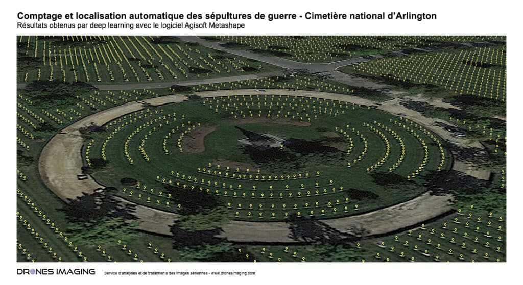
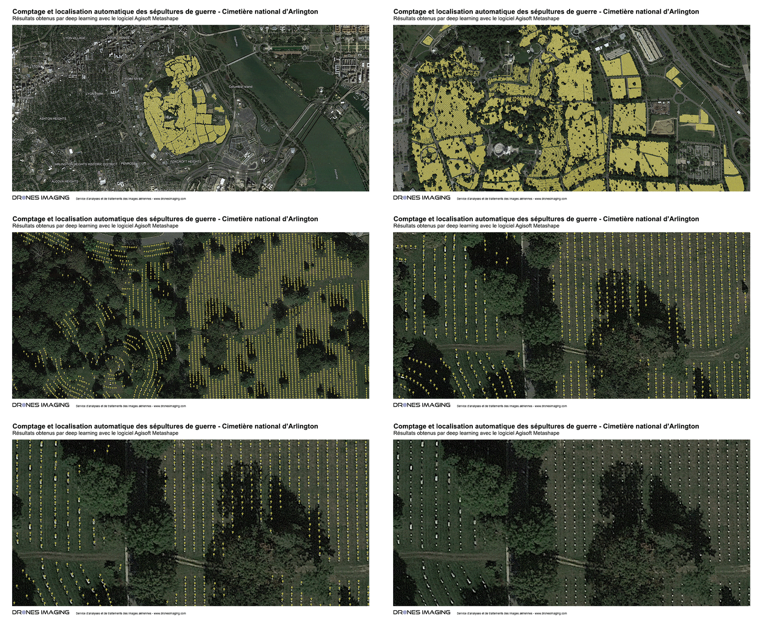
Automatic tomb counting at Arlington National Cemetery in the United States: results achieved through Deep Learning. Post-processing and image analysis by Drones Imaging.
Located across from Washington, D.C., near the Pentagon, Arlington Cemetery was listed on the National Register of Historic Places in 2014. Spanning a vast 250-hectare expanse, the cemetery holds the graves of over 290,000 individuals, including veterans from all American wars, from the War of Independence to contemporary conflicts of the 21st century, such as the Iraq and Afghanistan wars. This necropolis encompasses significant periods from both World Wars, the Korean War, and the Vietnam War.
On this massive site, the combined use of high-resolution imagery from Google Earth and Deep Learning techniques from Agisoft Metashape enabled precise automatic mapping of each visible burial site. This process revealed approximately 180,000 graves in this specific context, noting that those concealed under vegetation remain undetectable.
Nevertheless, this endeavor confirmed the exceptional power and stability of the software in a big data context. The detection of 180,000 objects was achieved in less than an hour of computation, on an image mosaic displaying a resolution of 7 cm. These results underscore the impressive capability of Agisoft Metashape to operate effectively in demanding environments, reinforcing its relevance in various applications, including mapping and precise localization of a large number of objects.
Automatic Tomb Counting


TECHNICAL INFORMATIONS
- Automatic service counting : Drones Imaging company.
- Aerial imagery : Google Earth.
- Spatial accuracy : unknow.
- Resolution : 7cm GSD.
- Area : 250ha.
- Number of Counted Graves : 180000.
- Photogrammetry software : Agisoft Metashape.
