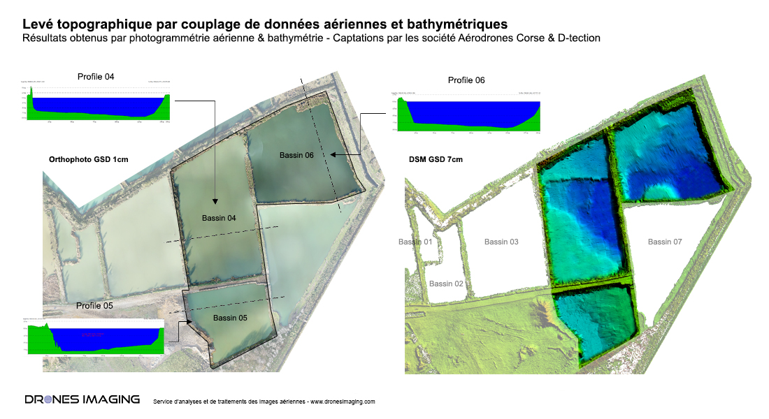
Bathymetry and aerial photogrammetry over a 55ha quarry
Bathymetry and aerial photogrammetry: results obtained from 740 aerial images taken by I-Techdrone company and subsequently merged, with more than 100,000 bathymetry points recorded by the D-tection company. Post-processing by Drones Imaging.
Bathymetry merged with the existing topographic survey for measurement of exploited cubatures

Above the topographic survey carried out within the framework of the annual operating plans with topography of the aquatic bottoms for the measurement of cubatures in the basins.
TECHNICAL INFORMATIONS
- Aerial images post-processing service : Drones Imaging company.
- Flights and aerial images capture : I-Techdrone company.
- Bathymetry : D-Tection company.
- Spatial accuracy : centimeter.
- Orthophoto RVB : GSD 2cm.
- Covered area : 55ha.
- Drone : MikroKopter.
- Camera : SONY A7R.
- Photogrammetry software : Metashape.
- Export formats : GéoTiff and Dwg autocad.
- Delivery delay : 3 days.
