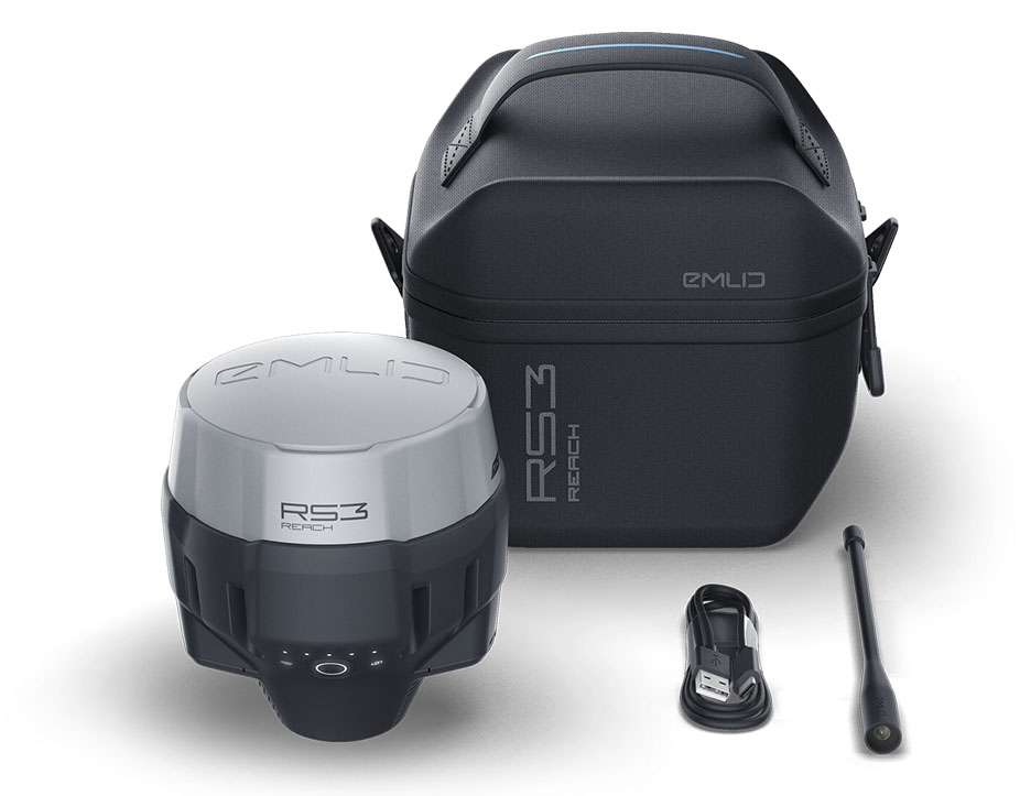
Emlid RS3, the next-generation receiver with IMU tilt compensation
The EMLID RS3 receiver is fully compatible with all correction services, including Orphéon, Teria, Centipède, and other similar solutions. It stands as an ideal turnkey solution for topographic surveys, site layouts, or data collection with unparalleled centimeter-level precision
2499€ including technical support and training
Engineered to be tough
IP67 - RS3 is waterproof up to to 1m depth. Tested -20°C...+65°C
Covered with elastomer
This is a rubber-like material that forms a shock absorber around the whole device
Rugged 5/8" mount
A precision CNC machined threaded mount is inserted during the molding process and becomes one with the plastic
LoRa radio & UHF
868/915MHz Frequency range Up to 8km UHF 450MHz
Industrial battery
LiFePO4 charges from any USB port and power bank / 2000+ cycles
Compatibility with Common Correction Services (Mainland France, Overseas Territories, and Others)
The Reach RS3 receiver directly receives correction data (such as Teria, Orphéon, or Centipède for France) through your smartphone’s GSM network. It establishes its coordinates within seconds, even in challenging conditions. No additional equipment or software is required; all you need is a smartphone connected via Wi-Fi or Bluetooth.
Regarding correction data and file formats, the Reach RS3 supports NTRIP, RTCM3, and RINEX, providing you with maximum flexibility in selecting correction settings and data recording.
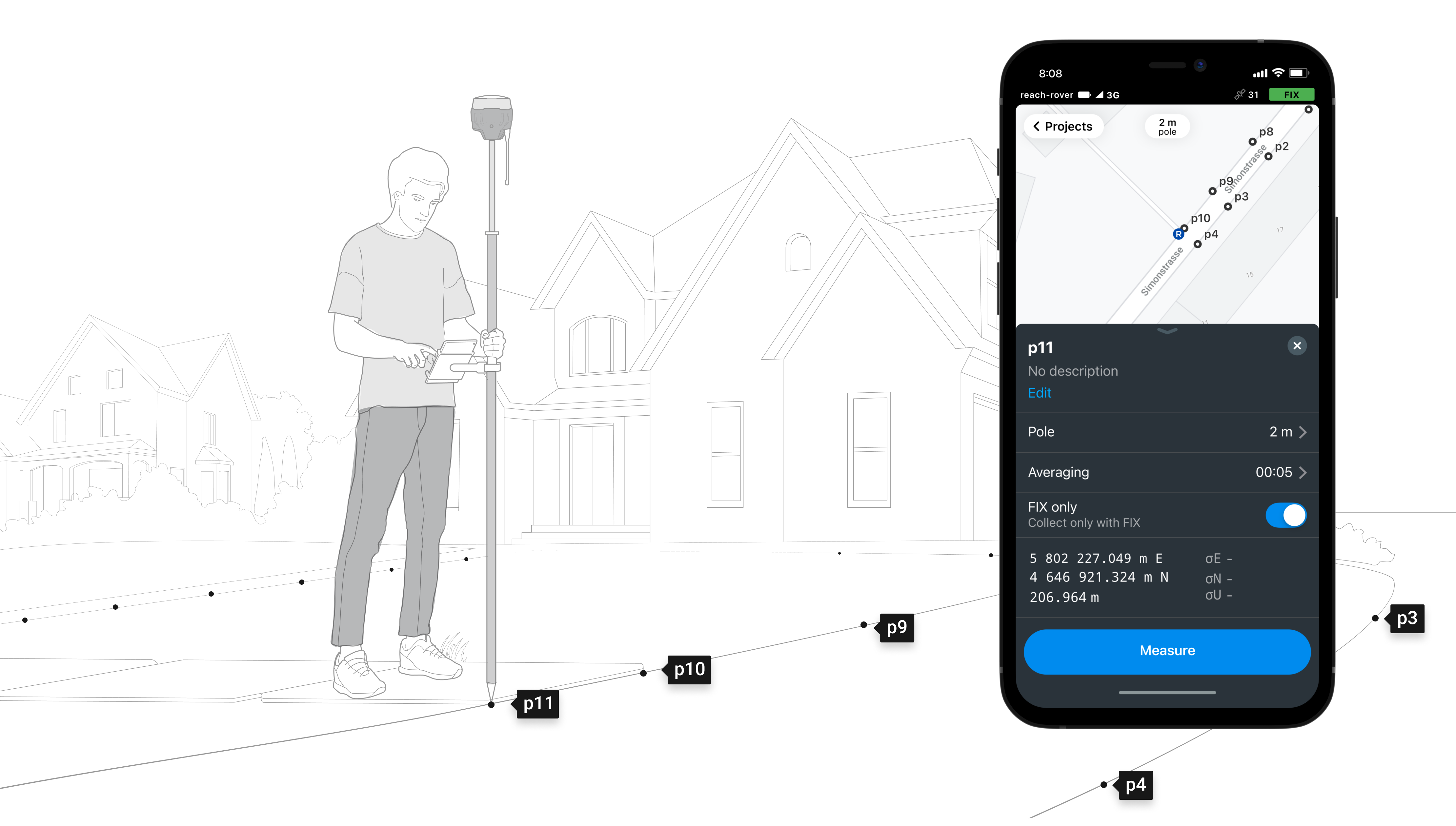
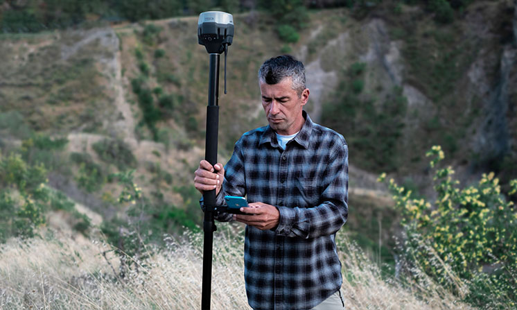
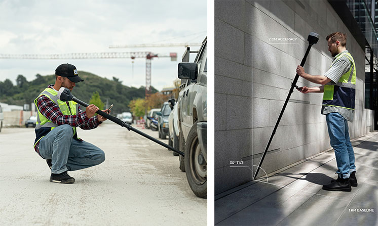
IMU Tilt Compensation for Hidden Point Collection (building angle and Other Scenarios)
The Reach RS3 is equipped with the latest IMU tilt compensation technology, enabling high-quality data acquisition even in the most challenging environments, such as building corners, tree bases, and more. This in-house-developed technology by Emlid ensures top-tier RTK precision, with an error margin of only +2 mm and +0.3 mm per degree. Additionally, the IMU comes factory-calibrated, ensuring immediate functionality upon device startup.
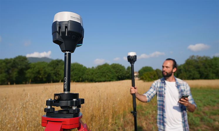
Interoperable, the RS3 receiver operates in base/rover configuration
In the absence of a GSM network and, consequently, the ability to receive real-time corrections, you have the option to use two Reach RS3 receivers. One of them will be configured as a base station, broadcasting the necessary corrections to the second receiver, which will be set up in rover mode. This configuration enables you to conduct local surveys or connect to a specific coordinate system. Additionally, you will have the capability to continuously record log files for later post-processing operations.
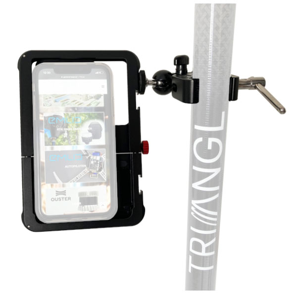
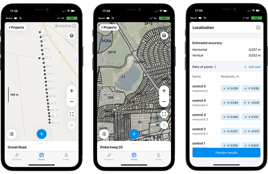
Customize your projects, record points with attributes and descriptions tailored to your requirements, and set guidelines to monitor the recording duration. Data capture is fast and intuitive through the user-friendly Emlid Flow interface, designed with similarities to commonly used mapping applications.
NAVIGATION
During real-time navigation, Emlid Flow can guide you to previously recorded points. When you approach a point within 50 cm, the application’s interface switches to ‘target view’ mode. You can then move the receiver to align the indicators on the screen, and when the display turns green, you’ve reached your destination.
LOGGING
Real-time data recording is possible in either NMEA or RINEX format for post-processing.
They have chosen Emlid and placed their trust in us