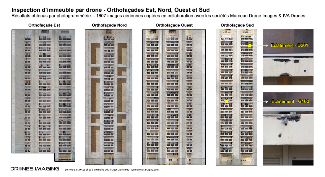
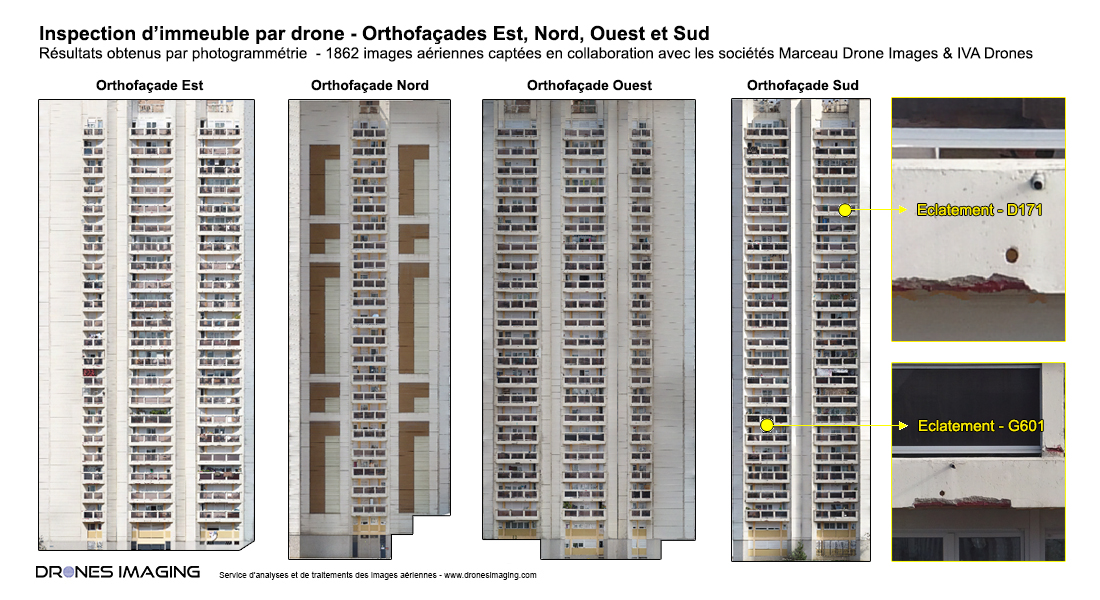
Facade inspection by drone: results obtained from 3500 aerial images as part of a renovation project for two high-rise buildings.
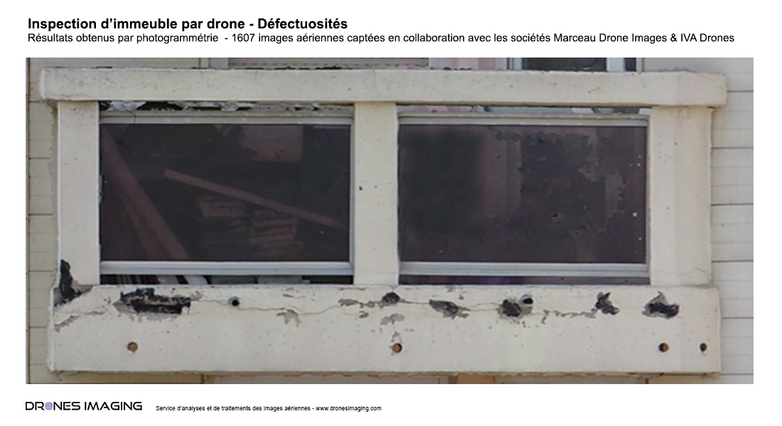
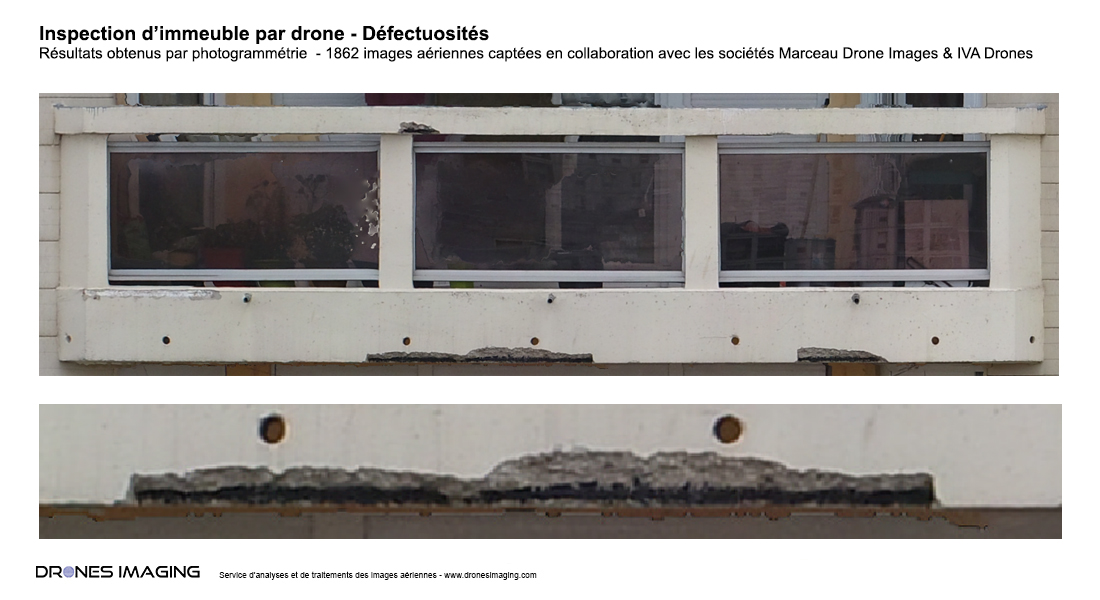
Orthofacades built in GeoTiff formats for the detection and localization of exposed reinforcement, concrete spalling and cracks.
Below are some examples of photographic signatures on the balconies.
TECHNICAL INFORMATIONS