Automated counting of grapevine plants in Yonne
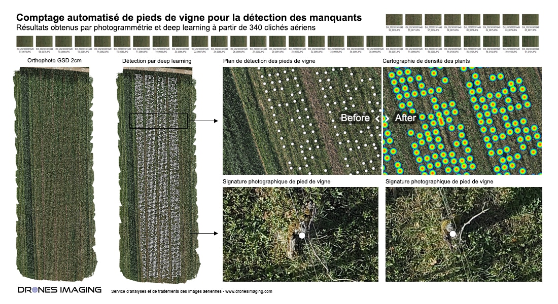
Grapevine plant counting and missing plants: results achieved through photogrammetry and deep learning from 340 aerial shots captured by D-Tection. Image post-processing and analysis by Drones Imaging.
Automated counting of grapevine plants to detect missing ones is essential for winemakers wishing to optimize the quality and production of their grapes. This task can be long and tedious to perform manually. That is why advanced technologies, such as drones equipped with high-resolution cameras, have been developed to automate this task.
Thanks to sophisticated object detection algorithms and advanced imaging techniques, these drones can quickly fly over vineyards and capture detailed images of each row of vines. The collected data is then processed to automatically count the number of grapevine plants present in each plot, allowing winemakers to detect missing plants and take the necessary steps to replace them.
RGB orthophoto, mapping of the 2891 plants, and spatial distribution analysis for missing plant detection.

The use of drones for grapevine plant counting offers many advantages. It allows for more accurate and faster results than manual counting methods, while saving valuable time and money resources. By quickly detecting missing plants, winemakers can ensure regular and quality grape production while maximizing their yield.
Drones Imaging, a company specializing in photogrammetry and image analysis, collaborated with D-Tection, a company specializing in drones, to capture and process high-resolution aerial images of vineyard plots in Yonne. Thanks to photogrammetry and deep learning, algorithms were able to accurately detect missing plants on vineyards, providing winemakers with a detailed view of their vine health.
In summary, automated grapevine plant counting with drones is a technological innovation that brings considerable benefits to winemakers. It allows for optimized production of quality grapes while minimizing costs and maximizing yield.
TECHNICAL INFORMATIONS
- Automatic counting service : Drones Imaging company.
- Flights and aerial capture : D-Tection company.
- Spatial accuracy : metric.
- Number of erial images : 340.
- RGB orthophoto : GSD 2cm.
- Total inspected area : 0.6ha.
- Number of counted plants : 2891.
- Drone : DJI M300.
- P1 sensor resolution : 8192×5460.
- Photogrammetry software : Metashape.
