![photogrammetry training metashape](https://www.dronesimaging.com/wp-content/uploads/pages/formation_metashape/Agisoft_photogrammetrie.jpg)
Expert in imagery processing and analysis, discover our photogrammetry training.
The strong point of our training: from the the client's need to the marketing of your productions (the deliverables), post-processing is part of an operational cycle, each stage of which requires great rigor.
Our photogrammetry training addresses all these steps such as the sectors & customers targeted, the different image acquisition protocols, settings & the finesse of the software, quality control of your productions, their compatibility, the different delivery methods as well than after-sales service.
![Cycle formation photogrammétrie](https://www.dronesimaging.com/wp-content/uploads/pages/formation_metashape/cycle_formation_Agisoft_Drones-Imaging©.jpg)
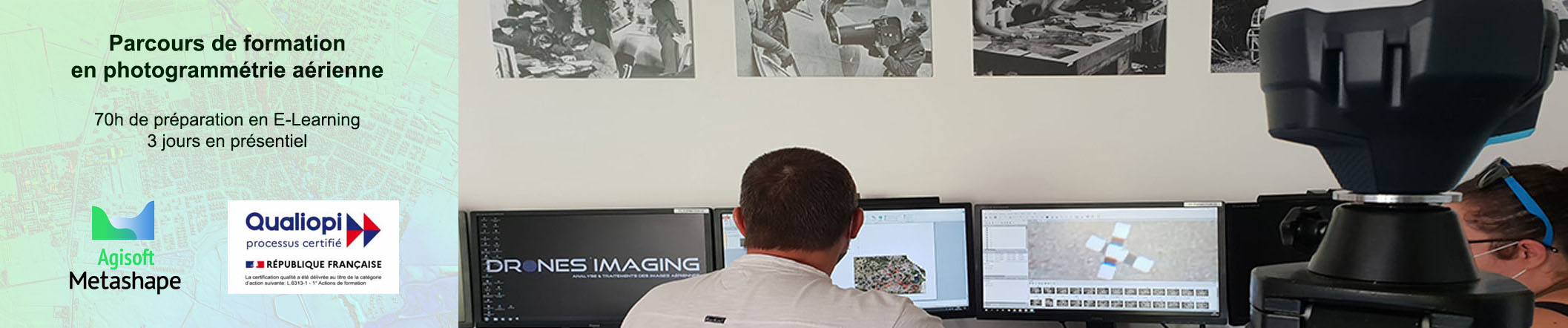
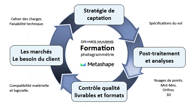
Our training is provided in two stages: 70 hours remotely and 3 days in face to face with our experts at the office. This training following 4 main steps:
1-The needs of the market and professional outlets.
2–Adjusting camera settings and image capture strategy (depending with the type of service).
3–Post-processing, workflow, adjusting software settings and 2D/3D data generation.
4-Quality control, centimetric accuracy and after-sales service.
Educational content
- Objectives: mastering Metashape software to build and market 2D & 3D data useful to surveying professionals.
- Candidates: pilots, geomaticians, surveyors, topographers, architects, engineers, military and any profile passionate about 3D.
- Prerequisites: basic computer skills and fluency with Windows OS.
- Hardware: a dual-screen PC configured for photogrammetry (I7 processor and 64GB RAM) is assigned to each student. Also, a GNSS RTK receiver is available to each learner for a grip with the instructor throughout our training.
- Duration and terms: 70h remotely and 25.5h face-to-face during three days.
- See more about our training schedule.
- Attendance rate: 100%
- Training cost: 2250€
- Contact
Extracts of deliverables built during our training
Building Information Model and orthofacades
Topographic surveys and volumetry report
Change detections
![](https://www.dronesimaging.com/wp-content/uploads/pages/formation_metashape/before_exercice_photogrammetrie.jpg)
![](https://www.dronesimaging.com/wp-content/uploads/pages/formation_metashape/after_exercice_photogrammetrie.jpg)
They chose our training center
![61](https://www.dronesimaging.com/wp-content/uploads/pages/agisoft_metashape/Logo_61.jpg)
![Minarm](https://www.dronesimaging.com/wp-content/uploads/pages/agisoft_metashape/logo_minarm.jpg)
![bspp](https://www.dronesimaging.com/wp-content/uploads/pages/agisoft_metashape/logo_bspp.jpg)
![Marine nationale](https://www.dronesimaging.com/wp-content/uploads/pages/agisoft_metashape/logo_marine.jpg)
![DGA](https://www.dronesimaging.com/wp-content/uploads/pages/agisoft_metashape/logo_dga.jpg)
![gendarmerie](https://www.dronesimaging.com/wp-content/uploads/pages/agisoft_metashape/logo_gendarmerie.jpg)
![28](https://www.dronesimaging.com/wp-content/uploads/pages/agisoft_metashape/Logo_28.jpg)
![Airbus](https://www.dronesimaging.com/wp-content/uploads/pages/formation_metashape/logo_airbus.jpg)
![Engie](https://www.dronesimaging.com/wp-content/uploads/pages/thermographie/logo_engie.jpg)
![Veolia](https://www.dronesimaging.com/wp-content/uploads/pages/formation_metashape/logo_veolia.jpg)
![sncf](https://www.dronesimaging.com/wp-content/uploads/pages/agisoft_metashape/logo_sncf.jpg)
![Eurovia](https://www.dronesimaging.com/wp-content/uploads/pages/mines_et_carrieres/logo-eurovia-vinci.png)
![transwater](https://www.dronesimaging.com/wp-content/uploads/pages/formation_metashape/logo_transwater.jpg)
![Alta](https://www.dronesimaging.com/wp-content/uploads/pages/formation_metashape/logo_alta.jpg)
![cerema](https://www.dronesimaging.com/wp-content/uploads/pages/formation_metashape/logo_cerema.jpg)
![cirad](https://www.dronesimaging.com/wp-content/uploads/pages/agriculture/logo_cirad.jpg)
![GE](https://www.dronesimaging.com/wp-content/uploads/pages/agisoft_metashape/logo_geometre.jpg)
![terrasol](https://www.dronesimaging.com/wp-content/uploads/pages/formation_metashape/logo_terrasol.jpg)
![Ifao](https://www.dronesimaging.com/wp-content/uploads/pages/formation_metashape/logo_ifao.jpg)
![Changins](https://www.dronesimaging.com/wp-content/uploads/pages/agriculture/logo_changins.jpg)
![Terres inovia](https://www.dronesimaging.com/wp-content/uploads/pages/agriculture/logo_terres_inovia.jpg)