Solar panels inspection by drone
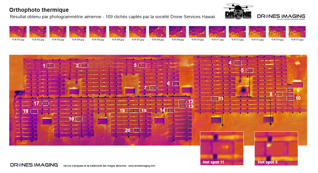
Solar panels inspection from a thermal infrared orthophoto. October 2016. Result obtained from a thermal video taken by Hawaii Drone Services with the FLIR XT camera. Post-processing service by Drone Imaging.
Thermal orthophoto for the control and maintenance of solar panels
Aerial thermal video
Thermal orthophoto built from 109 aerial shots (frames taken from the video above) to detect and localize defective photovoltaic cells.
TECHNICAL INFORMATIONS
- Thermal imagery processing service : Drones Imaging company.
- Flights and aerial imagery : Drone Services Hawaii company.
- Spatial accuracy : relative decimeter.
- Thermal orthophoto : GSD 1cm.
- Drone : DJI.
- Sensor : FLIR XT.
- Area : 2000m².
- Photogrammetry software : Agisoft Metashape.
- Export formats : GeoTiff.
- Delivery times upon receipt of data : 24h.
- Use case taught in training : see more.