Terrestrial photogrammetry applied to BIM
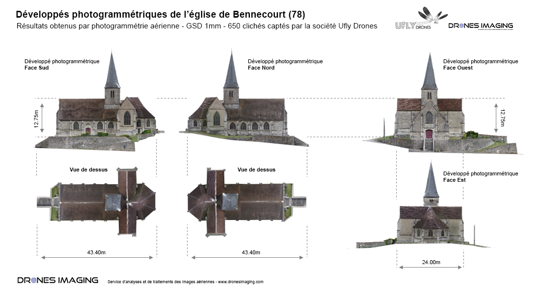
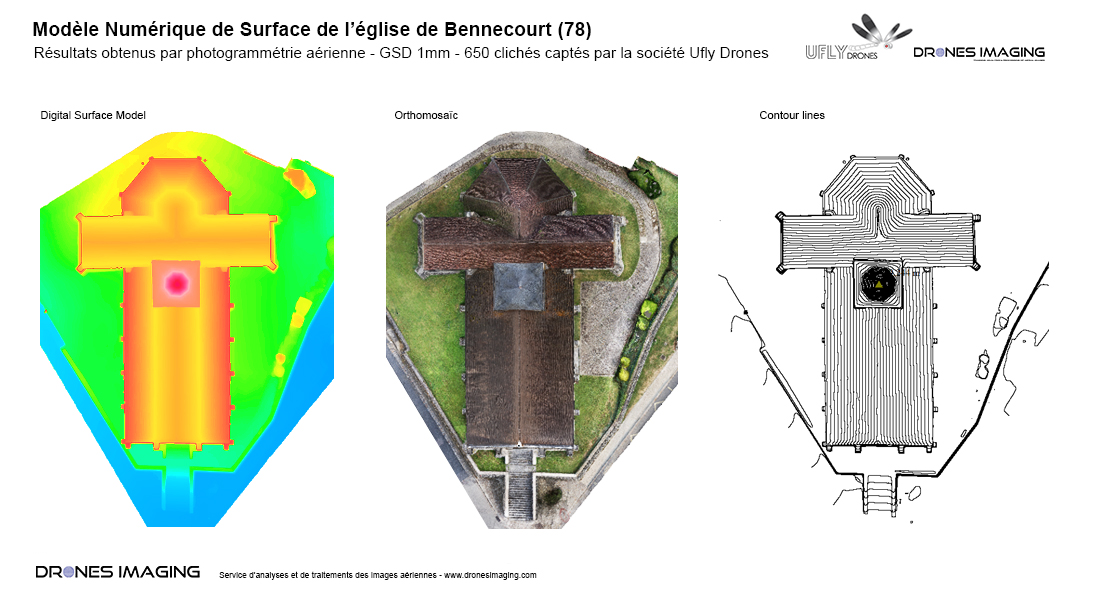
Terrestrial photogrammetry and digital twin of the church of Bennecourt. Topographic survey, October 2016: results obtained from 650 terrestrial images taken by Ufly Drones, post-processed by Drones Imaging.
Orthophotos of the roof and the four facades of the church


BIM model 3D visualization
Topographic survey carried out without drone, by photogrammetry from land shots. This 3D restitution technique is currently the most efficient and economical solution for carrying out precision surveys with complex facades.
TECHNICAL INFORMATIONS
- Aerial imagery processing service : Drones Imaging company.
- Terresrial imagery : UFLY Drone company.
- Spatial accuracy : centimeter.
- Orthophoto RVB : GSD 1mm.
- Inspected areas : 4 facades + 1 roof.
- Camera : SONY RX100.
- Photogrammetry software : Metashape.
- Delivery time upon receipt of images : 24h00.
- Use case taught during our Agisoft Metashape training : see more.
