Topographic survey of an industrial site
Topographic survey and roofs inspection of an industrial site. Results obtained from 495 aerial shots taken by Aerial Data company. Aerial image post-processing service by Drones Imaging.
High resolution orthophoto and Digital Surface Model
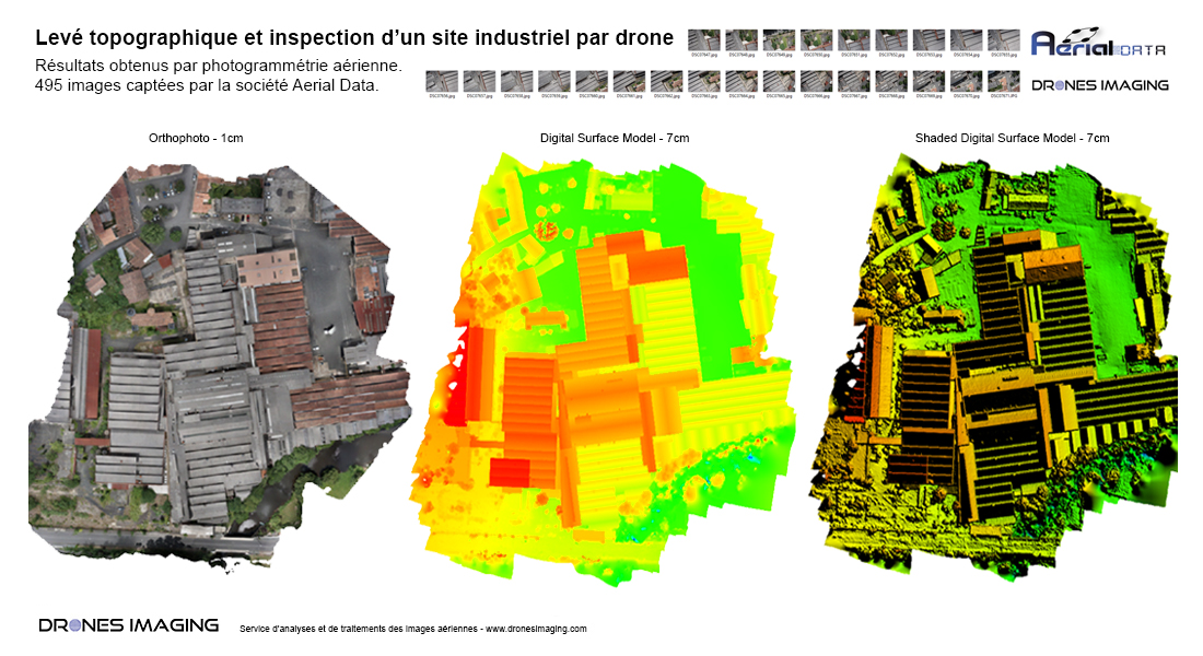
Topographical survey (1cm planimetric and 3cm altimetry accuracy) built by aerial photogrammetry and delivered with 10 millions points cloud (5cm density) + orthophoto. Compatible with Autocad covadis, dense cloud provided and orthophoto will subsequently allow the production of a complete topographic plan of the industrial site.
TECHNICAL INFORMATIONS
- Aerial imagery post processing service : Drones Imaging company.
- Flights and aerial imagery : Aerial data company.
- Spatial accuracy : centimeter.
- Orthophoto RVB : GSD 1cm.
- Covered area : 03ha.
- Drone : DJI.
- Photogrammetry software : Metashape.
- Export formats : GéoTiff and Dwg Autocad.
- Delivery delay : 4h00.
- Use case taught during our photogrammetry training : see more.